Dopshari
Dop-Shar-ri Gewog comprises of 21 villages and 619 households. It lies in the east of the Dzongkhag. The Gewog shares its boundary with Doteng Gewog in the North and Hungrel Gewog in the south. Distance to Dop-shar-ri Gewog from Dzongkhag Administration is about 2kms
The Gewog is divided into 5 Chiwogs: Duezhi_Jipa, Jangsa_Jooka, Jizhigang, Kempa_Kuduphu and Rinchhending_Shari. All the chiwogs are connected with farm roads with 98% of the households have piped drinking water facilities and 100% households have electricity connections. It has a total population of 3180 out of which 1590 is male and 1590 is female.
The economy is based on agriculture, mainly dry land and wetland cultivation of paddy, wheat, potatoes, apples and dairy products.
1) | Area | 33.89 sq. km |
2) | Altitude Range | 2260-3700meters |
3) | Forest Coverage | 72% |
4) | Number of Chiwogs | 5 |
5) | Number of Villages | 21 |
6) | Number of Households | 619 |
7) | Population | 3180 |
8) | Male | 1590 |
9) | Female | 1590 |
10) | Special Needs | 12 |
Facility | Number | Description (Distance from Gewog Office, Year of establishment, etc.) | Remarks | |
1) | Gewog Office | 1 | It was estd. in the year 2008 and its located Shari chiwog |
|
2) | RNR Extension | 1 | It was established in the year 2008 is located within Gewog office boundary |
|
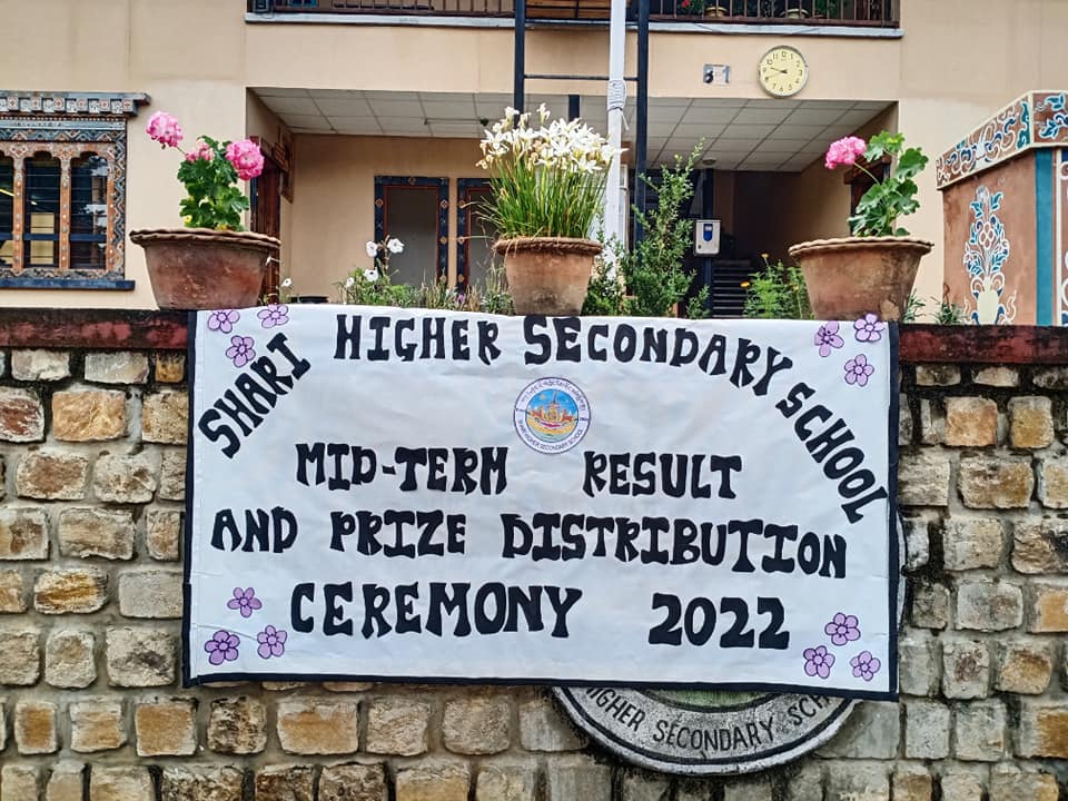
3) | School | 1 | Founded on 10th Feb, 2000 as community school and upgraded to Higher Secondary School in 2007. Distance to school is about 1.5km from Gewog office |
|
4) | BHU | 0 | NA |
|
5) | ORC | 1 | 5kms from the Gewog Office and its located in Jizhigang. Maintenance work in process |
|
6) | Community Center | 1 | Estd. On 2017, CC is located within the Gewog compound |
|
7) | Irrigation Canal | 18.32kms | Tadingkha-Chothakha, Bara Thachukha-JukaJangsa, Drapikhimjap, GI sheet IC,Kuduphu, Bamzingkha, Tadingkha, Gangyur |
|
8) | Farm Road | 21.33kms | Rechukha-Shari, Richukha-Menchuna, Bara-Rinchhending, Rimdotselkha-Bemzingkha, Najikha-Hungrelkha, Chimakha-Menchuna, DuezhiTangkatse-JipaTajekha, Tajomo-Bemzhingkha, Jangsa, Kempa-Kuduphu, Damchengom, Tadzong-Damchena, Tadzong-Jeshigang |
|
9) | National Highway | 0 | NA |
|
10) | Bridges | 3 | One suspension bridge located at Jangsa, one motorable bridge near town and one is under construction at Damji |
|
11) | Number of Villages electrified | 21 | 100% coverage |
|
12) | Number of household electrified | 619 | 100% coverage |
|
13) | Number of village with RWSS scheme | 21 | 100 % coverage |
|
14) | Number of household with RWSS | 600 | 98% coverage |
Type of Land use | Acres | |
1) | Dry land
| 417.34 Acres |
2) | Wet land | 519.90 Acres |
3) | Vegetable production | 651.30 Acres |
4) | Fruit production | 175.76 Acres |
Sl.no. | Name | Designation/Location | Contact No. |
1. | TsheringDorji | Gup |
|
2. |
| Mangmi |
|
3. |
| Duezhi_JipaTshogpa |
|
4. |
| Jangsa_JookaTshogpa |
|
5. |
| JizhigangTshogpa |
|
6. |
| Kempa_KuduphuTshogpa |
|
7. |
| Rinchhending_ShariTshogpa |
|
8. | Tshering Norbu | Gewog Administrative Officer |
|
9. | TsheringDorji | Gaydrung |
|
10. | JyotiBala Rai | Accountant |
|
11. | PremBdr. Giri | Livestock Health Supervisor |
|
12. | Delma | Sr. Agriculture Extension Supervisor I |
|
13. | Tenzin Zangpo | Forest Ranger |
|
14. | ChunduDorji | Gewog Engineer |
|
15. | RinchenChundue | Driver |
|
16. | Karma Thonjay | Care Taker |
|
17. | Ugyen Drukpa | Technician |
|
18. | KhanduZam | CC Manager |
Institutions
Staff


Tourism
No tourist destinations in this Gewog.
Quick Links
- Assurance on Accuracy of CV
- Bhutan Computer Incident Response Team (BtCIRT)
- Bhutan NDI
- Bhutan Vaccine System
- G2C eServices – Citizen Services Portal
- Ministry of Health (MoH)
- Online On Application System (Process Citizenship ID Card/Special Permit and Relationship Certificate
- RCSC MAX System
- Security Clearance
- Zhiyog Electronic Systems (ZESt)

